Museums aren’t the only history-themed stops I like to make on a tour. While many landmarks lack some of the amenities that museums offer—like shelter from the elements—their existence marks a place or event that has been memorialized in the minds of other people. That, by itself, should give us reason to pause and take a look.
Maybe the aspect or period of history of a landmark isn’t significant to us individually, but oftentimes you learn the most by looking at the things you’re least familiar with.
Like the other articles in this series, the list below is restricted to places I have visited in person.

Iowa 80
Location: Walcott, Iowa (near Davenport)
While there’s a trucking museum that shares the name of this landmark (that is discussed in another article in this series on museums), the Iowa 80 is, on its own, a living piece of history. Billed as, “the world’s largest truckstop,” the Iowa 80 is very big and keeps getting bigger.
According to Iowa 80 Truckstop website (https://iowa80truckstop.com), the facility opened its doors in 1964 and has been continuously open for business since then. The idea to build a truck stop next to the not-yet-finished Interstate 80 expressway was hatched by Bill Moon, a Standard Oil executive. A year later, Moon took over operating the Iowa 80. In 1984, Moon purchased the Iowa 80 from Standard Oil’s successor-in-ownership Amoco, and the Iowa 80 is among the several trucking-related businesses owned by the Moon family today.
You don’t have to be a trucker to appreciate the sheer largess and many products and services the Iowa 80 offers. It’s website states that site’s main building has been remodeled or expanded 28 times since its opening and is home to more than half-a-dozen eateries, a truck showroom, “a dentist, a barber shop, a chiropractor, a workout room, laundry facilities, a 60-seat movie theater, a trucker’s TV lounge, 24 private showers,… a convenience store, a custom embroidery and vinyl shop, 42 gas islands, 16 diesel lanes, a fuel center, a seven-bay truck service center, a three-bay Truckomat truck wash, a CAT Scale [and] a Dogomat Pet Wash….”
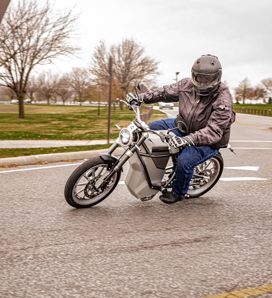
While motorcyclists aren’t hauling 80,000 pounds of cargo across the country like an over-the-road trucker is, the variety of services at the Iowa 80 makes it a great stop on a cross-country trip. Like motorcyclists, truckers can’t carry many personal belongings with them when they’re on the road. So, having somewhere like the Iowa 80 that offers so much more than a typical truck stop, restaurant or rest area can adds some pampering to the touring experience.
As a long-distance motorcycle rider, I’ve always felt a sense of connection with truckers. Like motorcyclists, truckers are road users who are sometimes misunderstood and treated poorly by motorists.Both groups also spend lots of time traversing the nation’s road network. When I stop at a truck stop for a meal, I look around for talkative truckers and pick their brains about the routes I’m going to ride later that day or the ones I have trips planned for. And what better place to find a trucker to talk to than a facility that has parking for 900 big rigs?


Fort Niagara
Location: Youngstown, N.Y.
If a future tour takes you through upstate New York, plan at least part of a day when you pass through Buffalo to check out Old Fort Niagara. It’s about a 40 minute ride from New York State Thruway exit 50 (for those traveling westbound on the Thruway) or exit 53 (for those traveling eastbound). Standing in the middle of the parade grounds of a pristinely-preserved 1700s fort is more than worth the detour.
Old Fort Niagara is located at the mouth of the Niagara River, where water from Lake Erie finishes its journey over the Niagara Escarpment (at Niagara Falls, about 15 miles to the south) to Lake Ontario. Prior to the completion of the Erie Canal in 1825, the portage (a ground route connecting two water routes) around Niagara Falls was of economic and military importance to the Western European powers. France constructed the first permanent fortification, the French Castle–which still stands as the largest building within Old Fort Niagara–in 1726.
The French constructed the earthen walls (they received a brick facade during the American Civil War) in preparation for the French and Indian War, yet the British captured Fort Niagara in 1759. The British held the fort during the American Revolution and surrendered it to the Americans at the end of the war. The fort was recaptured by the British during the War of 1812 and was returned to American possession in 1815. The U.S. Coast Guard maintains a presence just outside the old fortification, and the grounds to the east of the old fort continued to be used by other military branches through the 1960s.
The restoration of Old Fort Niagara took place in the 1920s, and those preservation efforts have resulted in a splendid, expansive example of military engineering and construction from the colonial era. The stone buildings remain in excellent condition, and the preserved earthworks give a visitor an excellent idea of the scale and nature of colonial era warfare.
Old Fort Niagara is open year-round and is the site of battle reenactments and other American military history-related events each year. I suggested planning at least 2 hours–if not 3 or 4–to adequately take in everything the site has to offer. Check out the fort’s website (https://www.oldfortniagara.org) to learn more.


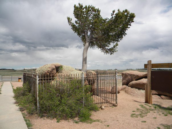
Tree in the Rock
Location: Buford, Wyo.
What may seem like an unusual–but otherwise insignificant–parking area in the median of Interstate 80 in southeast Wyoming is home to one of the coolest landmarks I’ve seen on a tour. In the middle of a circle of pavement accessible by a left-hand exit from I-80 in either direction stands something most unusual: a tree growing out of a large rock. The site is located near mile marker 333, about a 30-minuted drive from Cheyenne and about 20 minutes from Laramie.
Known as “The Tree in the Rock” or “Tree Rock,” it features a limber pine tree growing out of a crevice in a boulder. The boulder is held together by metal cable. According to the plaque placed into the side of the boulder, the tree/rock duo was discovered by railroad workers who were building the Union Pacific mainline in 1863. The mainline passed about 50 feet to the south of the landmark.
The site holds significance to me on both abstract and personal levels. In addition to its unusual appearance, I find the site to be inspirational. Seeing something that’s supposed to be impossible (a tree growing without an apparent soil bed) is a reminder that the improbable is not impossible. On a personal level, the Tree in the Rock is a symbol to me of the start of the American West. I saw the Tree in the Rock for the first time in 2010 on my first cross-country motorcycle trip (Buffalo, N.Y. to Salt Lake City, Utah). I had not had an opportunity to ride to the West again until last year and made the Tree in the Rock my turn-around point. Every fiber of my being wanted to keep going, but it was victory in itself as I pulled into the asphalt oval surrounding the landmark on Memorial Day weekend 2019.
There’s also more to see than just the Tree in the Rock. Visible across the westbound lanes of I-80 are a set of oblong-shaped, yellow- and red-colored boulders that appear to be stacked on top of one another. Signs along the westbound parking area state that the boulders were left the way they appear today by glacier activity. The size and height of the big rocks gives you a good idea of the scale of the glaciers that shaped North America’s landscape in prehistoric times.


Fort Ticonderoga
Location: Ticonderoga, N.Y.
Another colonial-era fort worth visiting in upstate New York is Fort Ticonderoga. Located southeast of the village it shares a name with, the fort was originally named Fort Carillion and was built by the French in 1755. It is located along a portage between the south end of Lake Champlain and the north end of Lake George and overlooks Lake Champlain’s South Bay. The fort was the scene of several battles in the French and Indian War and the American Revolution, and was abandoned as a military post after the British surrendered at Yorktown in 1781. It was purchased from the State of New York by a private citizen in the 1820s, and restoration work on the fort began in the 1920s.
While the vast majority of the stone work is not original, the restored stone walls, commanding overview of the bay and scenic setting give Fort Ticonderoga a very different vibe than Fort Niagara. The engineering flaws in the fort’s design and location (which you’ll learn about during your visit) add to its different vibe. The grounds also are home to a museum and gift shop that’s worth spending some time in after touring the fort.
There’s a neat, tree-lined driveway that you follow to get to the site’s parking lot, and the grounds are home to a lot more than just the fort. There’s also the six-acre King’s Garden, which is located on the property’s lower elevations to the northeast of the fort. There’s also battle reenactments and other programs at the site throughout the year. Check out the Fort Ticonderoga website (https://www.fortticonderoga.org). The fort and grounds are owned and operated by The Fort Ticonderoga Association, a charitable nonprofit.
One of the best parts of visiting Fort Ticonderoga is the ride there. Nestled in the scenic Adirondack Mountains, it’s a pleasant ride north on New York Route 22 from points south, such as Lake George–the home of the annual Americade rally.


Stapleton
Location: Denver, Colo.
If you stand at the intersection of Uinta Blvd. and M.L.K. Jr. Drive in Denver, Colo., you’ll see modern-style homes and apartments and the rolling hills of neighborhood greenspace on three sides. One the fourth side, there’s an abandoned air traffic control tower that’s been converted into a restaurant. No, it wasn’t relocated to the neighborhood. It’s the last remaining piece of what was once Denver’s bustling Stapleton International Airport.
Serving as Denver’s main airport until Denver International Airport was opened in 1995, what’s now the site of a New Urbanism-styled community was home to runways and concourses for more than 50 years. While it’s lack of terminal space, parallel runways and the developed land on its boundaries led to its demise, the site is a spectacular example of successful adaptive reuse.
Stapleton isn’t worth visiting just because of what it used to be; it’s also an example of what urban planners have in mind for new-built neighborhoods across the nation. It features a mix of multi-family and single-family detached homes placed on small lots with ample common greenspace. Many of the single-family detached homes have garages on the rear of their lots that open onto alleyways that run through the center of blocks of houses.
Take a moment when you visit Stapleton to stand somewhere and pull up some historic aerials of where you’re standing on your phone. Then just try to imagine standing in the middle of a giant runway while you’re parked on the shoulder of a pleasant residential street.


Graffiti Highway
Location: Centralia, Pa.
At press time, local media reports indicated that the graffiti highway is in the process of being covered over with dirt. The information below has been left in this article as a memento to what was one of the neatest places I’ve ever visited on two wheels and a prominent example of public art.
While visiting the Graffiti Highway is technically trespassing, it’s also one of the neatest places you’ll visit on two wheels. The highway is what remains of a four-laned section of Pennsylvania Route 61 that was constructed to serve the village of Centralia.
A coal mining town since the 1800s, Centralia was home to more than 1,000 residents in May 1962 when a large fire started in the abandoned coal mines below the town. It’s speculated that the fire started when the city tried burning the trash in the city dump, which was an abandoned mine pit on the east side of town. After decades of trying to get the fire under control, the village is now a ghost town, with most of the buildings gone and the grid of village streets remaining.
The four-lane portion of Pennsylvania Route 61 was eventually abandoned due to the underground fire causing unevenness and fissures in the pavement, and the route was reassigned to a two-lane road to the southeast.
The remains of the four-lane road has become a giant concrete canvas for graffiti artists and some juvenile delinquents with cans of spray paint. While some of the graffiti is amateur and immature in nature, the eclectic nature of what is there, combined with the ghost-road feel and the good works of graffiti make a visit a truly unique experience.
Be advised, if you choose to walk the highway, you do so at your own risk. The fire still burns, and the ground can give way at any time. Fissures in the ground can release carbon monoxide and other harmful gasses and the roadbed is uneven in many places.


Leave a comment